
This easy and rewarding 1.75 mile walk takes in the breathtaking views, across Windermere, from the top of Gummer’s How, near Newby Bridge, along with a beautiful secluded reservoir nearby.
We have previously walked up Gummer’s How, simply doing an out and back route, which is less than 1.5 miles. Today’s walk also took in the reservoir in the Birch Fell Plantation to the east of the fell, making it a nice circular walk.
Today’s walk was also our first outing for our Splashmaps all-weather material map. Most of the time it was worn by someone, doubling up handily as a pirate hat, sunshade and even a picnic mat at one stage! We also studied the distant fells, trying to figure out exactly which was which. I’m not sure we agreed, but the map was a hit!
So, details of the walk itself… you can park for free in the car park at grid reference 389875 on OS map OL7. Cross the road and you’ll find the start of the footpath just up a little bit on the left. It’s easy to navigate, simply follow the one path all the way to the top. There are even little yellow arrows to follow!
There are some superb trees to climb on the way up, make sure you don’t miss them!
Once you’ve taken in the spectacular views across south Lakeland from the top, head back the way you came for a short while. As the path turns right, there is an upturned tree stump with coins placed in it. Shortly after this, turn left and follow the smaller path across to a fence. Cross the fence and follow the path along to the reservoir.
The reservoir is a beautiful and quiet place, quite often the opposite of the Gummer’s How summit, which can get busy in peak season.
*Top Tip*
Gummer’s How is a well known tourist spot, so go early in the day, or out of season for a quieter summit!
Keep following the path past the reservoir, then turn right, which leads you downhill through the forest, eventually popping out on the road.
Turn right and walk along the road (uphill for a bit!) for approx 400 metres. Take a left onto Sow How Lane and you’ll then see a footpath on your right which will lead you back to the car park.
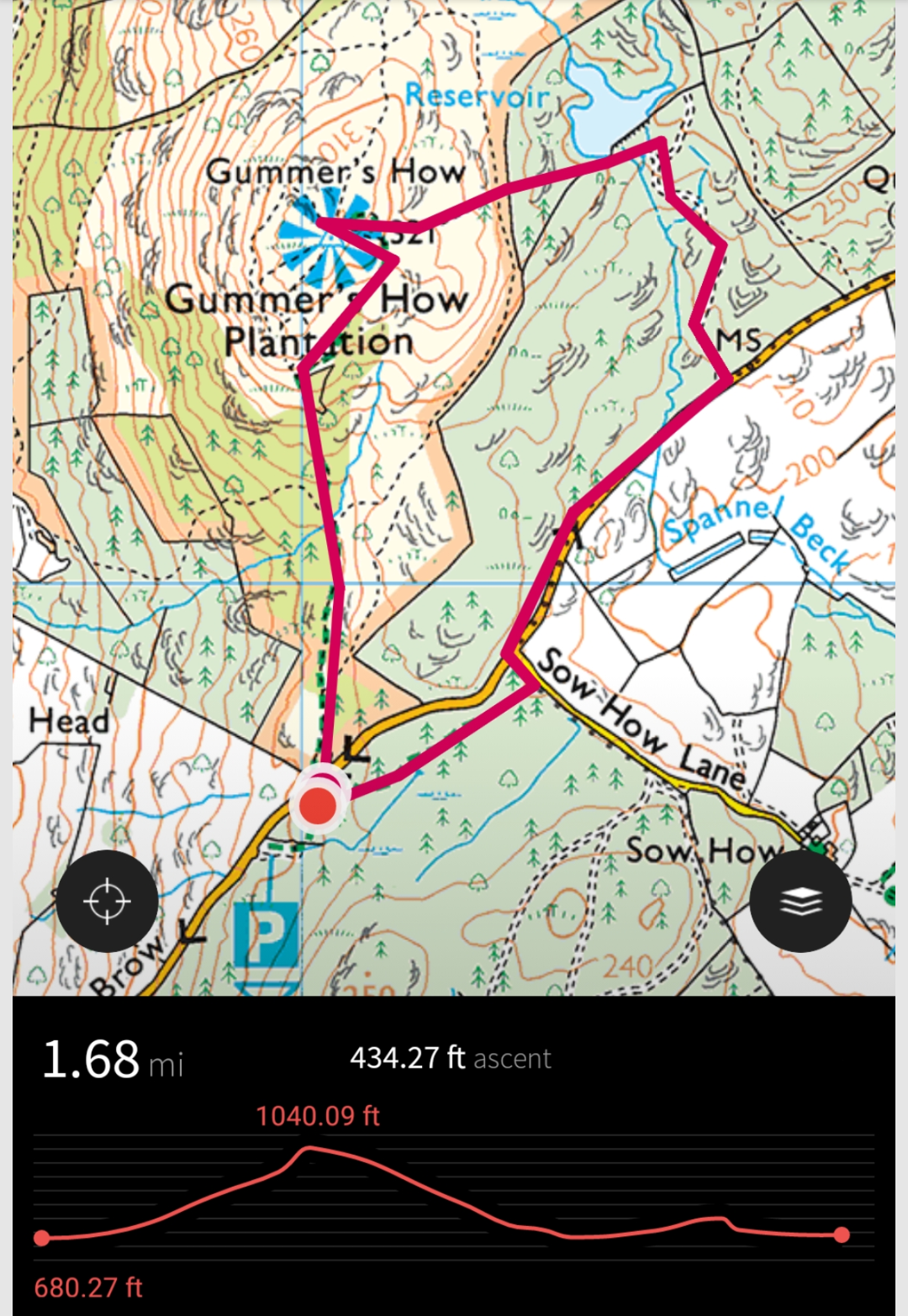
Here’s a route map, although we do, of course, always recommend taking your own map.
Today we had the very talented Glynis Bland with us, who was taking our annual family photographs. I’ll post a few of them on this page once we receive them.
Once you’ve finished your walk, there’s a lovely cafe, and superb picnic spot very close by, at Fell Foot Park. Simply drive down the hill and you’ll see the entrance opposite. There’s an accessible lake shore, playground, boat hire and large open grassy picnic fields.
For more walks like this, stay up to date and “like” our facebook page Family Walks and Pubs in the Lake District and follow us on Twitter @familywalklakes


Leave a comment